Mapping the Ocean is Good
And we've just had a breakthrough
The next time (and it probably will be sometimes soon) someone laments the political climate, or the cost of eggs, or the failing of their favorite sports team you now have a new tactic!
You can just reply to them and say, “Yeah, that’s tough… But did you know we are much closer to mapping the entire Arctic Ocean seafloor?”
And when they say, “Huh” you can just…
Well, you’ll have to read on to know what to say next…
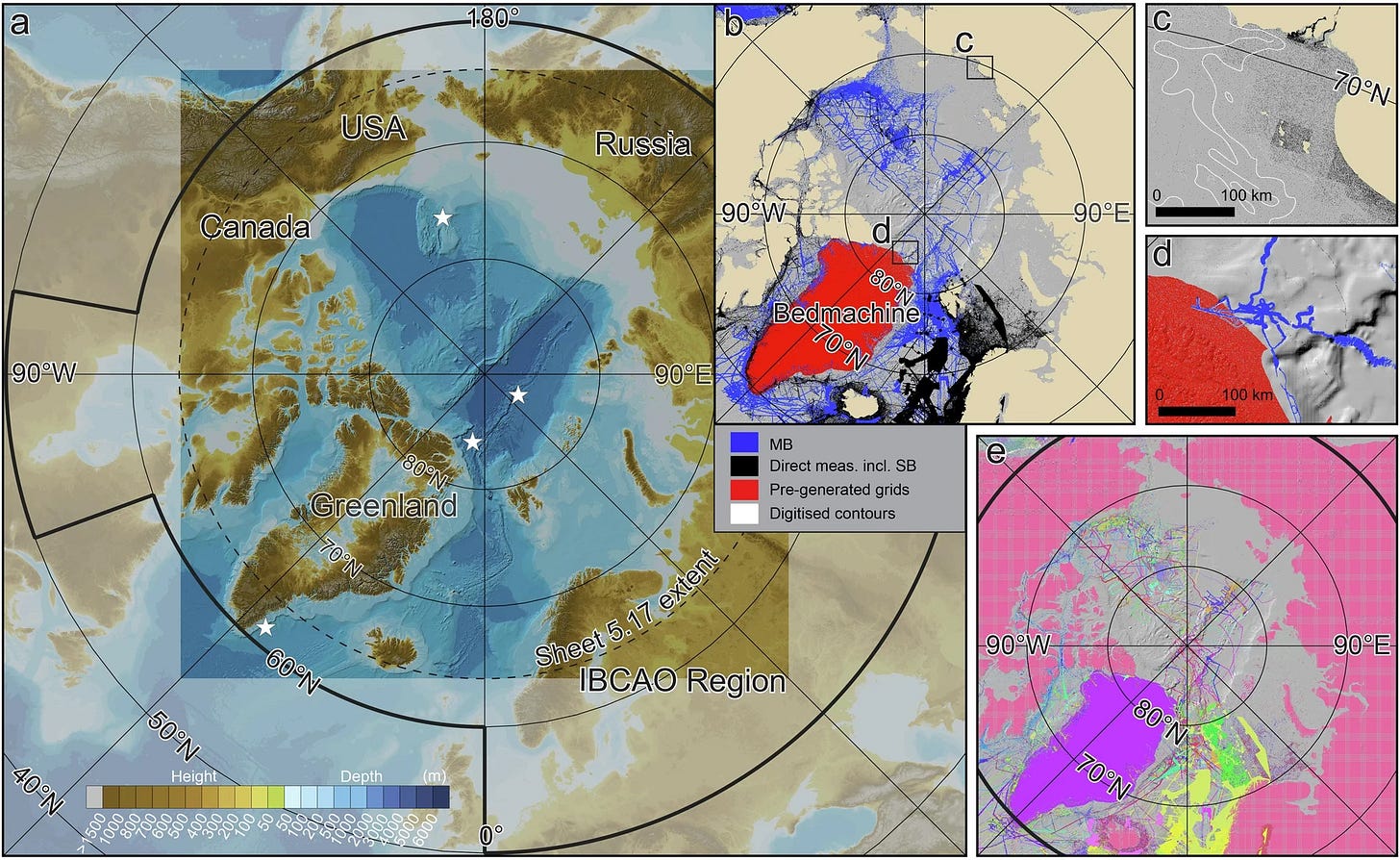
As names go, the International Bathymetric Chart of the Arctic Ocean is not going to get anyone’s juices flowing or heart racing.It is a dreadfully boring and impenetrable name.
Looking at it doesn’t really make it any better:
But it is important!
Bathymetry is not the study of bathtubs, it’s the study of the seafloor. It’s crucial for a lot of things that are important and going to be important including: science! industry! navigation! logistics! exploration!
It’s also hard. Mapping the Arctic Ocean means dealing with sea ice, submarines, ice drifts, ice stations, and, saddest of all, politicians and politics.
But the newly released version 5.0 is quite a breakthrough:
The new high-resolution dataset, representing 25.5% coverage of the Arctic region—up from 15.4% in the previous version
This update adds almost a million square miles of new land and data. That’s 3x Sweden!
It also has humanity and the world on track to have the entire Earthly ocean mapped by 2030. That’s the seafloor for all of the world.
Adds mind-blowing detail and specificity to the Arctic seabed.
Early iterations of these seafloor maps were composed of 2.5-kilometer grid cells as compared to Version 5.0's astounding 100-meter resolution. That’s a 100x increase in precision!
Most importantly, this is more than a scientific milestone — what’s best here is that this opens new opportunities for all of us. This was Russian, Canadian and European scientists working with Americans to bring us much closer to the ambitious goal of complete ocean floor mapping by 2030, while providing an unprecedented foundation for human advancement in the Arctic region. It stands as a shining example of what humanity can achieve through dedication, collaboration, and unwavering pursuit of knowledge.
This latest set of published data sets the table for safer navigation, scientific research and informed decision-making for ocean policy and exploration.
That’s a good thing.
Wait. No. Today we are going beyond good. Because this achievement is not just "good" - it's transformative.
Consider what this means: Every time you check the weather forecast, every time Amazon or UPS plots a shipping route, every time a new climate change model is generated. It’s better because of our improved understanding of ocean dynamics. And thanks to this collaboration, that understanding is exponentially more precise.
We can do hard things.
We can work together.
We can uncover the secrets of our planet.
That's not just good - that's extraordinary.


